
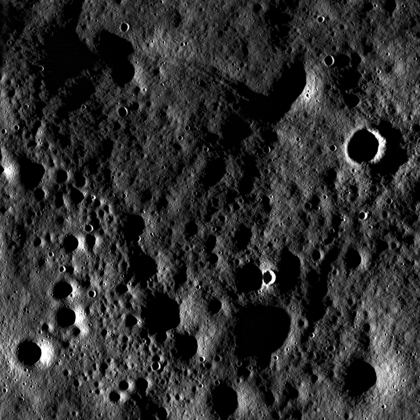
Rugged highland terrain on the farside of the Moon, south of Cantor (38.3°N, 118.6°E) crater, 830 km northwest of Mare Moscoviense. Featured Image from an early Commission Phase (LRO orbit 123) LROC Narrow Angle Camera observation M10137571R, swept up July 4, 2009; alt. 154 km, resolution 2.34 meters per pixel; field of view ~3.4 km. View the full-sized Featured Image HERE [NASA/GSFC/Arizona State University].
 Lillian Ostrach
LROC News System
Close-up view on the lunar farside south of Cantor crater (38.2°N, 118.6°E) taken at sunset (incidence angle 87°). Although the pronounced shadows hide the interiors of craters, the high incidence angle exaggerates the surrounding terrain so that subtle surface features are enhanced. In these lighting conditions, the Moon looks pulverized, softened, and pock-marked with craters of variable sizes and relative ages. Some craters are very bright and have well-defined rims while others are barely noticeable as shallow depressions.
The large number of craters influence the texture of the surface as the impact process removes material from the site of impact and transports it as ejecta onto the surrounding surface. The redistribution of ejecta material churns up the regolith (a process called impact gardening), smoothing the surface and filling in older craters. While there are many small craters (less than 100 meters in diameter) visible in this image, there are also much larger craters (hundreds to thousands of meters in diameter, such as the crater rim visible near the bottom of the full NAC image) in the vicinity of Cantor that are responsible for a significant redistribution of material. The surface in this NAC frame suggests that both the craters visible in this frame and those surrounding Cantor are responsible for the much of the surface texture we observe.

Browse the whole NAC image!
The large number of craters influence the texture of the surface as the impact process removes material from the site of impact and transports it as ejecta onto the surrounding surface. The redistribution of ejecta material churns up the regolith (a process called impact gardening), smoothing the surface and filling in older craters. While there are many small craters (less than 100 meters in diameter) visible in this image, there are also much larger craters (hundreds to thousands of meters in diameter, such as the crater rim visible near the bottom of the full NAC image) in the vicinity of Cantor that are responsible for a significant redistribution of material. The surface in this NAC frame suggests that both the craters visible in this frame and those surrounding Cantor are responsible for the much of the surface texture we observe.
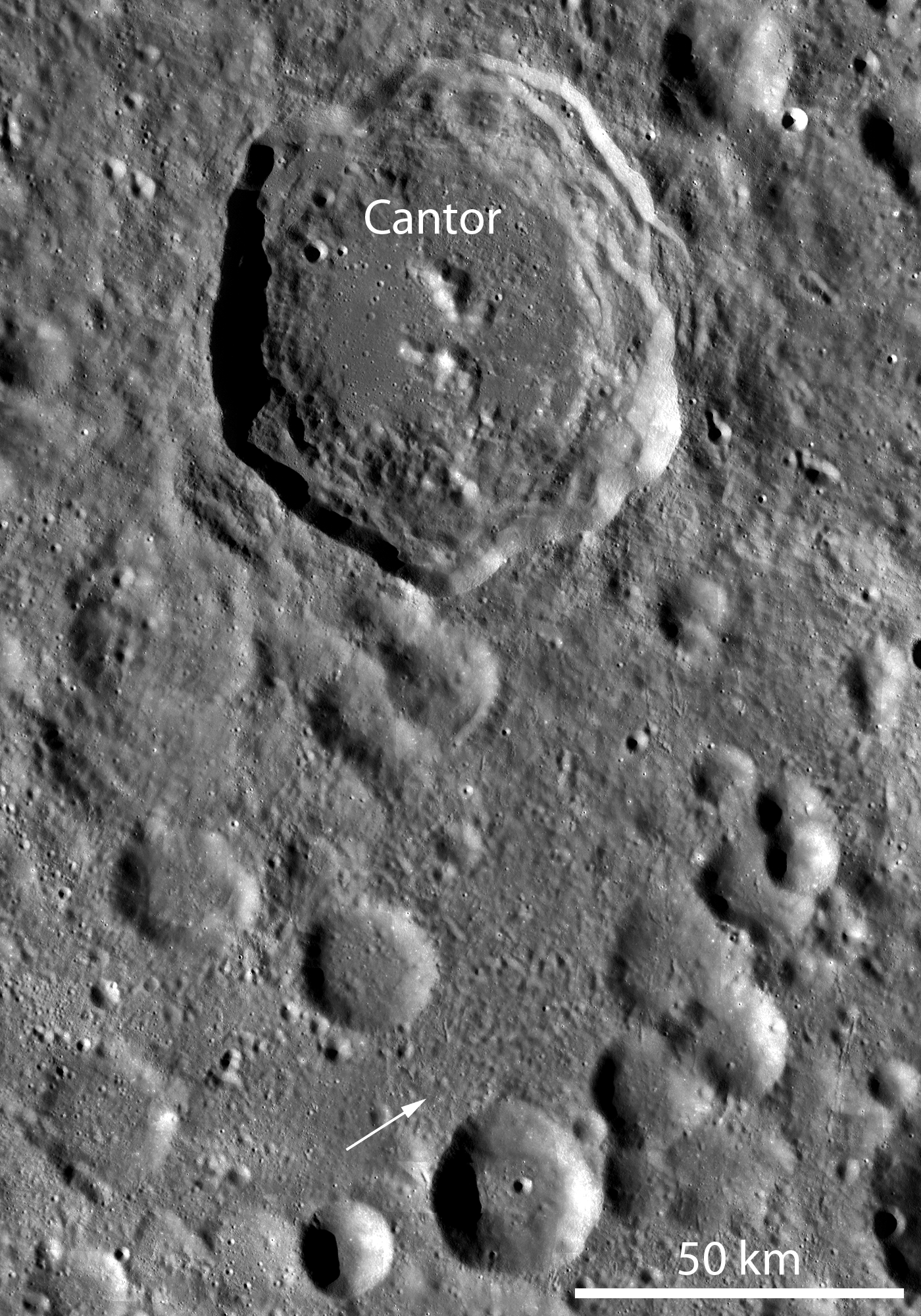
LROC Wide Angle Camera monochrome mosaic of Cantor crater and surrounding terrain. Cantor crater, ~81 km diameter, is slightly elongated in the north-south direction and has a polygonal-shaped rim. The arrow notes the location of the LROC Featured Image, February 15, 2011. The 38 km crater immediately to the southeast is Hogg (33.6°N, 121.9°E). Full-sized LROC image HERE [NASA/GSFC/Arizona State University].

A relatively small area in the LROC Featured Image (February 15, 2011) field of view was imaged again by the Narrow Angle Camera 10 months (and 3950 orbits) later. At the second opportunity, May 14, 2010, solar incidence was from the southeast-by-east at 53.4° Comparing differences in visible and invisible surface anatomy under different lighting conditions is striking (LROC NAC M101376571R & M128516328R) [NASA/GSFC/Arizona State University].
Browse the whole NAC image!
No comments:
Post a Comment